

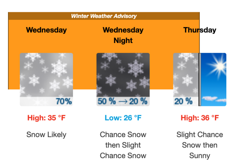
Feb. 18. Winter is back, with some kind(s) of precipitation likely tomorrow. The National Weather Service says snow is likely, mainly after 10 am. New snow accumulation of around an inch possible, possibly mixed with freezing rain and a high around 35 degrees. The storm winds down tomorrow night, with overnight lows around 26.
Thursday the chance of snow drops to 20 percent with a high near 36. Friday: Sunny, with a high near 44.
The eventual track and strength of a low-pressure system will determine precipitation types and amounts. With the current forecast, the best chance for accumulating snow is across the mountains and northern portions of central and eastern North Carolina. Impactful ice accumulations may be possible for portions of central and eastern North Carolina. With any ice accumulations of a quarter of an inch or greater, tree limbs can snap, and power outages may occur. It is important that all North Carolinians remain weather aware over the next day as the forecast will change and be fine-tuned as we get closer to Wednesday.