


Feb. 14. By Dave Vieser. A new north-south roadway—known as the Northcross Drive Extension—which will connect Cornelius and Huntersville west of I-77. The NCDOT unveiled preliminary details, including a sketch of the proposed route, Monday during a public information meeting at Lake Norman Baptist Church. Click here to view the map of the proposed route.
The route selected by the DOT is almost entirely in Cornelius and will connect with the north end of Northcross Drive, alongside the Stratford Forest subdivision, and then extend in a northwest direction through mostly vacant land until connecting with Eagle Ridge Way, which ends at Westmoreland Road.
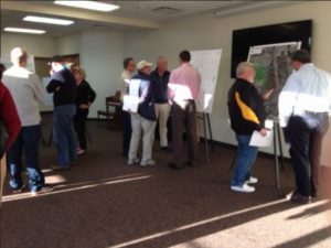
Local residents gathered at Lake Norman Baptist Church Monday evening February 13 to review preliminary plans for the Northcross Drive extension.
Eagle Ridge Way will be straightened under the NCDOT plan. About half of the planned route will traverse land owned by the Cornelius Parks Department. The new road will connect with the McDowell Creek Greenway.
The project is being managed by the DOT. “They will perform the engineering, right-of-way acquisition, and construction,” said Assistant Town Manager Andrew Grant.
The total project cost is estimated at $10.2 million; the town will provide $2.51 million in local matching funds. Funding for the extension is derived from Bonus Allocation Funds generated by the I-77 toll lane project.
“This is a prime example of building a local road where residents can get between Cornelius and Huntersville without using high volume regional thoroughfares such as Hwy. 21,” said DOT spokesman Warren Cooksey.
Current projections call for the acquisition of needed property to begin in 2019, with the two years needed for construction starting in 2020. One issue of major concern among local residents at the meeting was the future of the intersection at Eagleridge Way Lane and Westmoreland Road.
“A traffic analysis is already under way to study existing and future traffic volumes at that intersection,” Cooksey said. “The project will be designed so that the intersection accommodates anticipated traffic volume growth through 2040 in a safe and efficient manner. However, it is too early to know whether that means a new traffic signal, a roundabout or just a stop sign.”
The NCDOT will continue to accept comments from area residents on the project through Feb. 27. Once the comment period ends, DOT officials will review the citizen input and provide an updated plan to town officials.
Comments should be mailed to:
Brett Canipe,NCDOT Division 10 Project Team Lead, 716 W Main Street, Albemarle NC 28001